
A new Planning Support System (SSP) for green infrastructure is now available on the LET website to inform the Pla Director Urbanístic for the Barcelona Metropolitan Area.
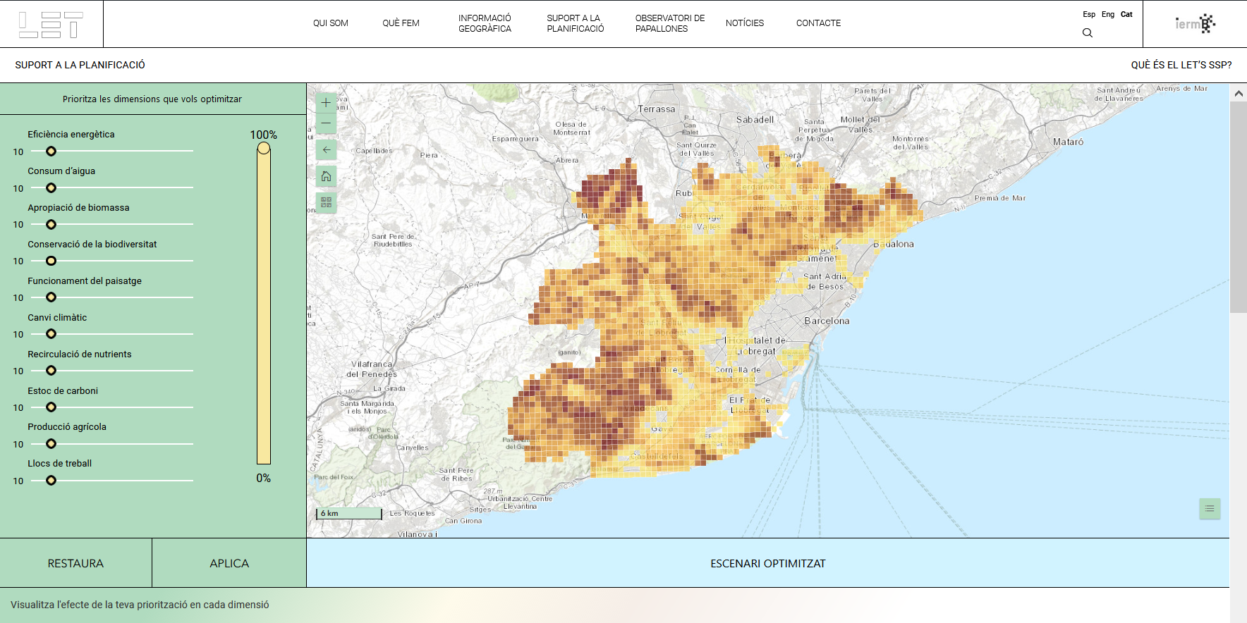
The Planning Support System (LET’s SSP) shows the current socio-ecological state of the open spaces of the metropolitan area of Barcelona, and it allows to generate future scenarios by changing both the land cover and the type of metabolism that characterize the green infrastructure. We present a pilot case in which you can optimize the possible future scenarios according to the priorities you would give to public policies.
In line with the objectives of the deployment of the Metropolitan Laboratory of Ecology and Territory of Barcelona (LET), the development of this Planning Support System (SSP-LET) responds to the main vision of: (i) providing tools for managing and planning green infrastructure at the metropolitan scale; and (ii) to promote the dissemination of knowledge and perspectives that treat the territory as a system, with the aim of reaching both technicians and politicians of the administration and society in general.
Thus, the SSP-LET is a meta-model that operates from the studies of analysis and prospecting of possible scenarios considered in the planning of the metropolitan green infrastructure, developed to respond to the needs of the Urban Master Plan of the ‘WITH. The model that serves as the starting database for the SSP is the Integrated Socioecological Analysis (SIA), which has been developed by the LET in collaboration with the PDU since 2018 and is still under development. The conceptual objective of the SIA is to define the contribution that green infrastructure makes to the whole of the metropolitan socio-ecological system, based on the characterization of various dimensions at the landscape scale (the 500 x 500 cell mesh has been adopted). m using the PDU).
The specific objectives of the SSP-LET are therefore the following:
- Show the socio-ecological status of the current scenario, and the likely status if the current urban planning is met (trend scenario), in relation to the contribution of green infrastructure throughout the metropolitan area.
- Disseminate the vision of green infrastructure as a complex system, where the multiple contributions it can make to the metropolitan area are interrelated through various dimensions that can lead to synergies and trade-offs.
- Allow the user to obtain possible optimized scenarios for planning the metropolitan green infrastructure, according to the criteria defined by the user.
- To publicize the work of the LET as a space for the development of new criteria and methods around the sustainable management of the metropolitan area.
- Make public the criteria and methods developed (including model scripts) in order to contribute to the transparency and applicability of SSP-LET in other territorial contexts.
- Contribute to the treatment of the metropolitan territory as a socio-ecological system, through a more transversal and democratic governance.